
GeoInfoMex

Category:Tools Developer:Servicio Geológico Mexicano
Size:2.95MRate:4.1
OS:Android 5.1 or laterUpdated:May 31,2025

 Download
  Application Description
Dive deep into the mysteries of Mexico with GeoInfoMex, the ultimate geological consultation app. Harness the power of geoscientific expertise at your fingertips and uncover the wonders hidden beneath the earth's surface. From geological-mining and geophysical data to geochemical maps, and from information about mines and beneficiation plants to fascinating rock formations, GeoInfoMex equips you with invaluable resources. Gain a deeper understanding of agrarian nuclei through the National Agrarian Registry and be captivated by the allure of CONANP-protected natural areas. Stay ahead of seismic activities with real-time earthquake updates from SSN and IG-UNAM. Unlock the secrets of Mexico's hydrology with data from Cencas, offering insights into its rich water resources. GeoInfoMex is your gateway to exploring the geological marvels of Mexico.
Features of GeoInfoMex:
Comprehensive Geological Insights: Access a vast array of geoscientific, geological-mining, and geophysical data about the Mexican Republic. Explore detailed maps and information related to geological-mining activities, geophysical studies, and geochemical mapping.
Mining and Rock Exploration: Discover essential details about mines, beneficiation plants, and remarkable rock formations across Mexico. Learn about their locations, characteristics, and other relevant information to enhance your geological knowledge.
Land Ownership Transparency: Gain insights into agrarian nuclei (ejidos) via the National Agrarian Registry. Obtain critical data on land ownership, boundaries, and more to better understand the geographical landscape.
Protected Natural Areas: Explore the beauty of CONANP-managed protected natural areas effortlessly. Whether you're passionate about eco-tourism or conservation, this feature offers valuable perspectives on Mexico's diverse ecosystems and their significance for biodiversity.
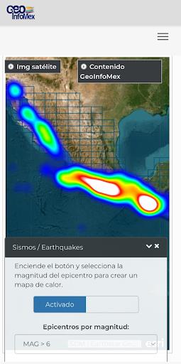
Earthquake Monitoring: Stay informed about seismic activities with real-time earthquake data from trusted sources like SSN and IG-UNAM. Receive timely updates on seismic events, magnitudes, and locations to ensure safety and awareness.
Hydrological Wisdom: Access hydrological data from Cencas, providing comprehensive reports on water resources, river basins, and water quality. Use this knowledge to make informed decisions regarding water management and conservation.
Conclusion:
GeoInfoMex is your indispensable companion for unraveling the geoscientific wonders of Mexico, catering to geologists, researchers, environmentalists, and curious minds alike. Click the download button today to embark on an extraordinary journey into Mexico's geological heritage!
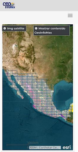
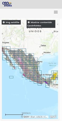
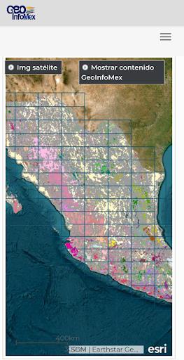
Screenshot
 Reviews
Post Comments+
Latest Apps
MORE+
Reviews
Post Comments+
Latest Apps
MORE+
-
 Vert ALPR - Mobile LPR Scanner
Auto & Vehicles 丨 201.5 MB
 Download
-
 ГСТ Водитель
Auto & Vehicles 丨 19.9 MB
Download
-
 Co-op Car Wash
Auto & Vehicles 丨 19.6 MB
Download
-
 QR-Транспорт
Auto & Vehicles 丨 24.1 MB
Download
-
 Ergon Mobile
Auto & Vehicles 丨 10.2 MB
Download
-
 Forever52 - Cosmetic Products
Beauty 丨 54.3 MB
Download
Similar recommendations
MORE+
Top News
MORE+

-
-
 How to Obtain Armadillo Scutes in Minecraft
Apr 16,2025
-
 Assassin's Creed Shadows Gets Censored in Japan
Mar 06,2025
-

Topics
MORE+
Trending apps
MORE+
-
1

willhaben16.92M
Experience Austria's leading marketplace with willhaben! Millions of classified ads, from unique fashion to vintage furniture, cars, properties, and jobs, are available for free buying and selling. Whether you're hunting for pre-owned treasures or clearing out your home, this app simplifies the pr
-
2

Radar Donostia3.8 MB
Donostia-San Sebastián Mobile Radar Locations Quickly find out where the mobile speed radar will be in Donostia-San Sebastián today. Get a daily notification detailing the streets where the radar will be deployed, or if it won't be in use that day.
-
3

zFont 3 - Emoji & Font Changer10.13 MB
Unlock the Power of Personalized Text with zFont 3 Premium APK! Tired of the same old fonts on your mobile device? zFont 3 Premium APK offers a revolutionary approach to mobile text customization, providing a vast library of fonts and stylistic options to transform your digital communication. This
-
4

AZ Beacons24.87M
Streamline your daily tech interactions with AZ Beacons, the ultimate Bluetooth connectivity solution for smartphones and nearby devices. This innovative app simplifies device pairing, offering a user-friendly interface for effortless connection management. Enjoy quick, stable connections regardle
-
5
Autel MaxiAP20093.2 MB
This advanced auto scanner offers swift and simple diagnostics for all vehicle systems. Provides free OBDII diagnostic capabilities. Includes one free vehicle release version. Supports 19 maintenance services, encompassing EPB, TPMS, BMS, brake bleeding, DPF regeneration, immobilizer key programmin
-
6

Psychology Dictionary Offline6.60M
Unlock the world of psychology with the handy, free Psychology Dictionary Offline app! This app provides thousands of psychology terms and definitions, readily accessible anytime, anywhere – even without an internet connection. Perfect for students and enthusiasts alike, it's a valuable resource f
10.13 MB
Download25.00M
Download35.50M
Download7.84M
Download10.63M
Download43.10M
Download