スーパー地形 - GPS対応地形図アプリ

Category:Maps & Navigation Developer:kashmir3d
Size:16.7 MBRate:3.3
OS:Android 5.0+Updated:Jan 03,2025

 Download
  Application Description
Super Terrain: Your Comprehensive Mapping and Navigation App
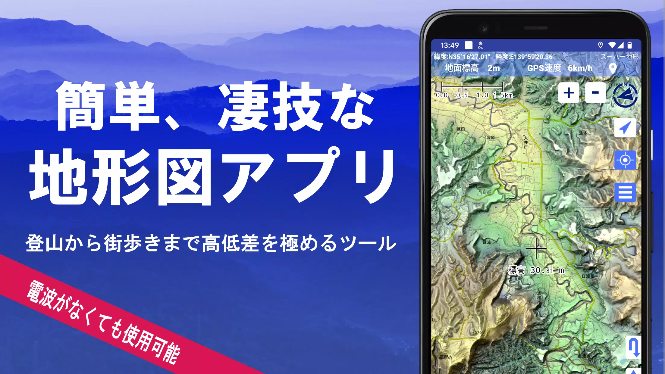
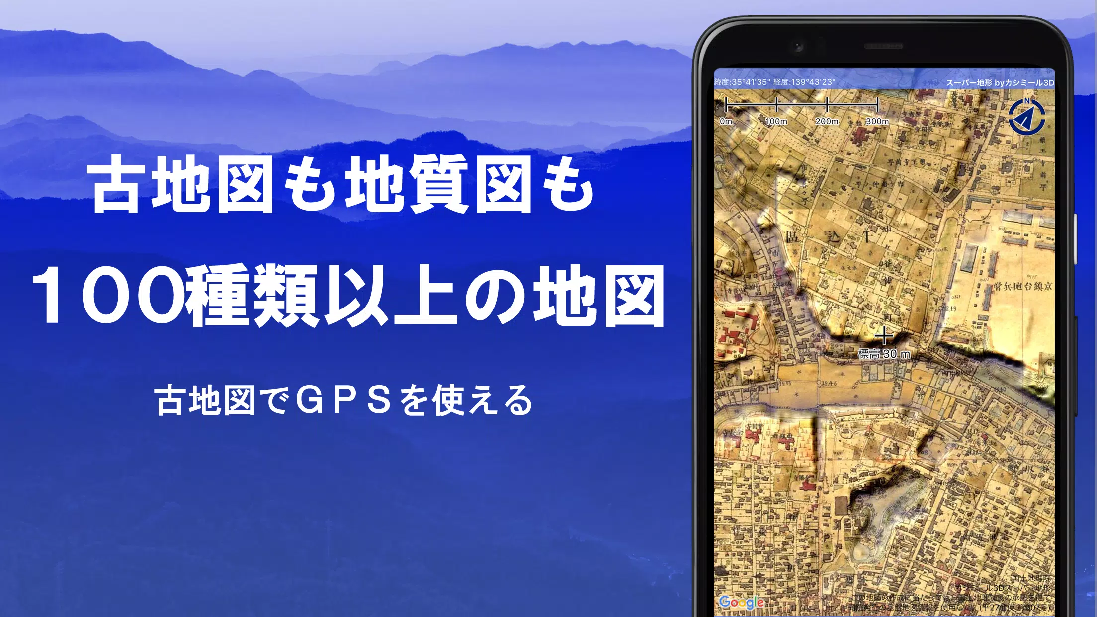
Super Terrain is a powerful mapping application boasting over 100 map types, including those from the Geographical Survey Institute of Japan. Whether you're hiking a mountain or navigating a city, its advanced features maximize your understanding of elevation changes. A recipient of the 2018 Japan Cartographic Society Award, Super Terrain offers unparalleled capabilities.
Key Features:
- High-Resolution Terrain Data: Utilize unique, high-resolution topographic data for superior visualization.
- Extensive Map Library: Access a vast collection of maps, including those from the Geospatial Information Authority of Japan (topographic, geological, historical, and more).
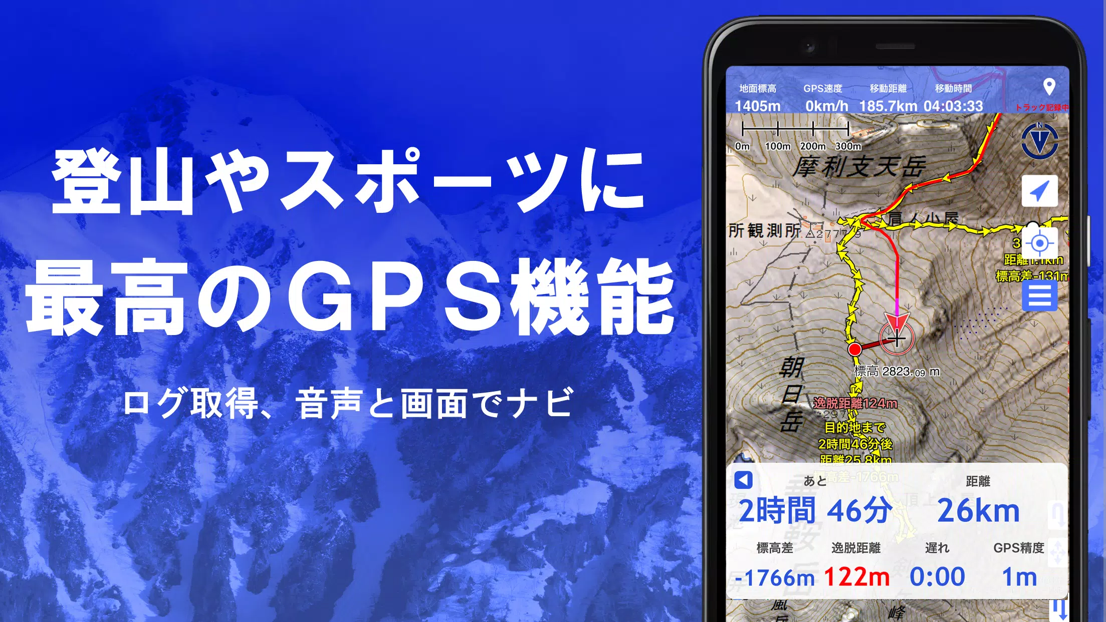
- GPS Tracking & Navigation: Record and manage tracks (GPX import/export), utilize precise GPS navigation (with audio guidance), and set point alarms.
- Offline Capabilities: Download maps in bulk for offline use, perfect for areas with limited or no signal.
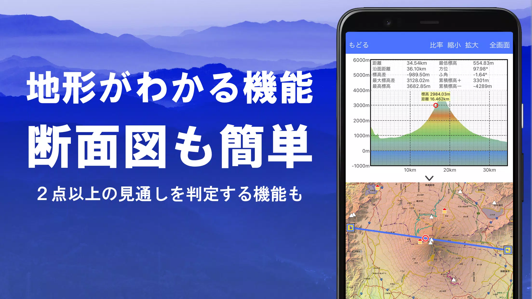
- Advanced Analysis Tools: Determine visibility for planning purposes (considerations for line-of-sight, radio transmission, etc.), create cross-sectional diagrams, and even include building data where available.
- 360° Panoramic Views: Identify mountains, display sun/moon positions, and view GPS points within a 360° panoramic view. Ideal for planning photography, particularly for capturing Diamond Fuji and Pearl Fuji.
- Image Integration: Associate photos with specific locations on your maps.
- Data Editing & Management: Edit GeoJSON files, draw shapes, and manage GPS data (points, routes, tracks) within a user-friendly interface.
- Versatile Output Options: Print maps or export them as PDFs.
- User-Friendly Design: Supports a dark theme for comfortable nighttime use. Includes a map history function for easy navigation.
- Custom Map Support: Import custom maps created with Kashmir 3D's map cutter.
- Data Backup & Restore: Back up all app data (excluding map caches) to prevent data loss. Automatic backups via Google Drive are also available.
- International Functionality: Use the app overseas.
In-App Purchases:
Some features, including access to super terrain data, advanced GPS tracking functions, and cross-sectional views, are available via in-app purchase (780 yen/year). A 5-day free trial is offered upon installation. Purchasing also increases the number of results in place name searches. Subscription management can be done through Google Play. Prices are subject to change.
Important Notes:
- Continuous GPS use may drain battery life. Consider carrying a spare battery, especially during extended outdoor activities.
- GPS recording may be interrupted on some smartphones due to power-saving features.
- For detailed navigation instructions, refer to the provided PDF: https://www.kashmir3d.com/online/superdemapp/superdem_navi.pdf
Super Terrain is a comprehensive mapping solution, perfect for hikers, climbers, outdoor enthusiasts, and anyone needing precise and detailed map information.
 Screenshot
 Reviews
Post Comments+
 Latest Apps
MORE+
-
 Gambeta total
Lifestyle 丨 10.10M
 Download
-
 m-Indicator: Mumbai Local
Travel & Local 丨 19.59M
 Download
-
 Fixture & Points Table Maker
Tools 丨 8.93M
 Download
-
 with HIVE
Communication 丨 3.40M
 Download
-
 Hippo Parking
Auto & Vehicles 丨 38.3 MB
 Download
-
 Shortform: Read Book Summary
News & Magazines 丨 19.00M
 Download
 Similar recommendations
MORE+
 Top News
MORE+
-
 Pokémon Go Rings in 2025 with Festive Fireworks
Jan 27,2025
-
 How to Obtain Armadillo Scutes in Minecraft
Apr 16,2025
-
 Assassin's Creed Shadows Gets Censored in Japan
Mar 06,2025
-
 Top 30 Greatest Games of All Time
Mar 06,2025
 Topics
MORE+
 Trending apps
MORE+
-
1

willhaben16.92M
Experience Austria's leading marketplace with willhaben! Millions of classified ads, from unique fashion to vintage furniture, cars, properties, and jobs, are available for free buying and selling. Whether you're hunting for pre-owned treasures or clearing out your home, this app simplifies the pr
-
2

Radar Donostia3.8 MB
Donostia-San Sebastián Mobile Radar Locations Quickly find out where the mobile speed radar will be in Donostia-San Sebastián today. Get a daily notification detailing the streets where the radar will be deployed, or if it won't be in use that day.
-
3

zFont 3 - Emoji & Font Changer10.13 MB
Unlock the Power of Personalized Text with zFont 3 Premium APK! Tired of the same old fonts on your mobile device? zFont 3 Premium APK offers a revolutionary approach to mobile text customization, providing a vast library of fonts and stylistic options to transform your digital communication. This
-
4

Psychology Dictionary Offline6.60M
Unlock the world of psychology with the handy, free Psychology Dictionary Offline app! This app provides thousands of psychology terms and definitions, readily accessible anytime, anywhere – even without an internet connection. Perfect for students and enthusiasts alike, it's a valuable resource f
-
5

AZ Beacons24.87M
Streamline your daily tech interactions with AZ Beacons, the ultimate Bluetooth connectivity solution for smartphones and nearby devices. This innovative app simplifies device pairing, offering a user-friendly interface for effortless connection management. Enjoy quick, stable connections regardle
-
6

Autel MaxiAP20093.2 MB
This advanced auto scanner offers swift and simple diagnostics for all vehicle systems. Provides free OBDII diagnostic capabilities. Includes one free vehicle release version. Supports 19 maintenance services, encompassing EPB, TPMS, BMS, brake bleeding, DPF regeneration, immobilizer key programmin

99.45 MB
Download12.3 MB
Download12.9 MB
Download6.5 MB
Download57.7 MB
Download33.1 MB
Download